Time and stone : the emergence and development of megaliths and megalithic societies in Europe
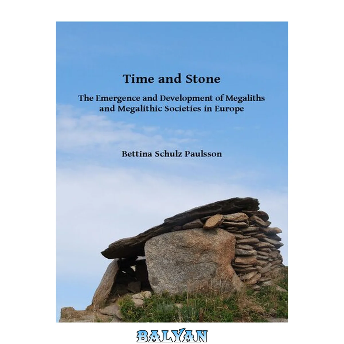
معرفی کتاب «Time and stone : the emergence and development of megaliths and megalithic societies in Europe» نوشتهٔ [美] 约翰·刘易斯·加迪斯 و Bettina Schulz Paulsson، منتشرشده توسط نشر Archaeopress Access Archaeology در سال 2017. این کتاب در فرمت pdf، زبان انگلیسی ارائه شده است.
This analysis is concerned with the dating of megaliths in Europe and is based on 2410 available radiocarbon results from pre-megalithic and megalithic sites, the megaliths' contemporaneous contexts and the application of a Bayesian statistical framework. It is, so far, the largest existing attempt to establish a supra-regional synthesis on the emergence and development of megaliths in Europe. Its aim is to assist in the clarification of an over 200-year-old, ongoing research debate. About the Author Dr. Bettina Schulz Paulsson obtained her MA in Prehistoric Archaeology/American Anthropology in 2005 at the Humboldt /Freie Universität in Berlin/Germany and her PhD in 2013 at the graduate school “Human development in Landscapes”/ Christian-Albrechts Universität Kiel. Recently, she has been appointed to the Department of History, at the University of Gothenborg/Sweden as a Marie Sklodowska-Curie Research Fellow, funded under the EC’s Horizon 2020 Research and Innovation Initiative. Her main research is on the Neolithic, with a particular focus on scientific dating, megaliths, rock art studies, cognitive archaeology and symbolic systems. Copyright Page 4 Contents 5 Chapter 1 19 Megaliths and megalithic societies in Europe 19 Introduction and central research questions 19 Theories on the emergence and spreading of megaliths 20 Investigated megalithic regions 25 Figure 1.1 The megalithic regions in Europe and North Africa (after Camp 1961; Whitehouse 1981; Soulier 1998; Burl 2000; Kalb 2001; Malone 2001; Trump 2002; Sjögren 2003; Piccolo 2007; Scarre 2007; García Sanjuán 2009; Cicilloni 2010; Fritsch et al. 2010a 20 Figure 1.2 Dolmens world-wide. Drawings from Montelius 1905 Orienten och Europa. 1. India, p. 11, Figure 4; 2. Krim, p. 14, Figure 8; 3. Sudan, p. 16, Figure 9; 4. Portugal, p. 23, Figure 13; 5. Palestine, p. 13, Figure 6 22 Figure 1.3 The modified diffusionism of Gordon Childe in Europe and his successors. Passage graves are seen as derivations of Cretan passage graves (after Renfrew 1973, 46) 23 Figure 1.4 Estimates for the start of construction of accessible megaliths from Müller (1998), based on the then available 606 radiocarbon results out of megalithic and long barrow contexts. The time intervals are showing the approximate modified values f 24 _GoBack 27 Chapter 2 27 Methodical Approach: Radiocarbon Dates and Bayesian Chronological Modelling 27 The radiocarbon dates 27 Composition of data 27 Classification of the contexts and data quality 28 Alternative dating approaches 30 The Bayesian approach 31 Figure 2.1 Number of radiocarbon dates considered in this volume obtained from different material types (n=2410) 28 Figure 2.2 Number of radiocarbon dates from charcoal samples identified after wood species (n=102) 28 Figure 2.3 The charcoal samples: classification of the contexts (n=944) 28 Figure 2.4 Classification of the sample contexts 29 Figure 2.5 Simulation A by a process of back-calibration of calibrated dates for 25 radiocarbon determinations which actually date within 25 y from 4000‒3976 BC 32 Figure 2.6 Sum calibration of simulation A. The bar marks the actual time span and shows that a sum calibration would extend the real time interval 4 times 33 Figure 2.7 Simulation B by a process of back-calibration of calibrated dates for 30 radiocarbon determinations which actually date within 300 y from 4100‒3800 BC 34 Figure 2.8 Sum calibration of simulation B. The bar marks the actual time span and shows that a sum calibration would extend the real time interval by more than 50% 35 Figure 2.9 Sum calibration versus Bayesian statistical framework. The analysis of all available radiocarbon dates for the Bell Beaker contexts in Southern France (Lemercier et al. 2014, Figure 13) show the large discrepancies between the two different met 35 Figure 2.10 The calibration curve Intcal09 (Reimer et al. 2009). Detailed the for this analysis important time intervals 36 Chapter 3 37 Northwest France 37 Pre-megalithic structures and pre-megalithic funeral rites in Northwest France 37 Pre-megalithic structures in the Paris Basin/Northern France 37 Pre-megalithic structures in Brittany and on the Channel islands 48 Pre-megalithic structures in the Central West France 51 Transitional structures and the emergence of megaliths in Northwest France 52 The emergence of megaliths in the Paris Basin/Northern France 53 The emergence of megaliths in Brittany and the Channel Islands 54 The emergence of megaliths in Central West France 65 Appearance and architectonical features of megaliths in Northwest France 65 Megaliths in the Paris Basin/Northern France 65 Megaliths in Brittany and on the Channel Islands 66 Megaliths in Central West France 68 Megalithic structures with radiocarbon sequences and radiocarbon dates 69 Megaliths with radiocarbon results in the Paris Basin/Northern France 69 Megaliths with radiocarbon results in Brittany and on the Channel Islands 72 Radiocarbon Results for Human Bones from Megalithic Graves in Brittany 73 Multi-Phased Megalithic Structures in Brittant Finistère 75 Morbhian 79 Channel Islands 86 Megaliths with radiocarbon determinations in Central West France 89 Dating the megaliths on the basis of the artifacts 99 The material in the early megaliths 99 The material in the passage graves 99 The material in the later megalithic grave forms 100 The burial rites of megalithic societies in Northwest France 101 Burial rites in the Paris Basin/Northern France 101 The burial rites in Brittany and on the Channel Islands 101 Burial rites in Central West France 103 Contemporaneous non-megalithic burials 105 Contemporaneous non-megalithic burials in the Paris Basin/Northern France 105 Dry Wall Structures 105 Wooden Gallery Graves 109 Pit Burials and Secondary Deposits or Ossuaries 110 Burials in Rock Shelters 111 Houses for the Dead 111 Hypogea 111 Contemporaneous non-megalithic burials in Brittany and on the Channel Islands 111 Contemporaneous non-megalithic burials in Central West France 112 Conclusion 112 Figure 3.1 Planum necropolis Passy (Lemercier et al. 2010) 38 Figure 3.2 Necropolis Passy. The monuments of sector A and B with burials and radiocarbon determinations 40 Figure 3.3 Probability distributions of dates from the necropolis Passy (cf table 3.1). Model 1 is established under the assumption, that all monuments of sector A and sector B belong to one necropolis and the same society. Model agreement: Amodel=98, A 41 Figure 3.5 Span A, sector La Sablonnière 43 Figure 3.6 Span B, sector Le Richebourg 43 Figure 3.7 Reconstruction of the Passy graves. Drawing by the author after G. Tosello, (Constantin et al. 1997) 43 Figure 3.8 Planum necropolis Balloy, Le Réaudins with the available radiocarbon dates (planum after Mordant 1997, 450) 46 Figure 3.9 Probability of dates from Balloy, Le Réaudins. Model agreement: Amodel=101.7, Aoverall=105.9 47 Figure 3.10 Necropolis Fleury-sur-Orne (Desloges 1994: 532) 48 Figure 3.11 Rots (Desloges 1994: 518) 49 Figure 3.12 Reconstruction of a double burial in Téviec, Museum Toulouse. Photo courtesy of Didier Descouens - CC-by-sa /Wikimedia Commons 49 Figure 3.13 Planum of the double burial A in cist, Téviec (Midgley 2005, 59; Péquart et al. 1937) 50 Figure 3.14 Goumoisière, cists 1, 2, 3, and 5 (after Soler 2007: 117) 52 Figure 3.15 Probability of dates from all available radiocarbon results in the cist burial site Goumoisière. Model agreement: Amodel=85, Aoverall=82.7 53 Figure 3.16 The tumulus Carnacéen St. Michel in Carnac with probability of radiocarbon dates. Planum according to Le Rouzic 1932 and Boujot/Cassen 1992. Photo of green stone artifacts with the kind permission of Serge Cassen, University Nantes (Cassen 201 55 Figure 3.17 The tumulus Carnacéen Tumiac. Planum after Fouquet 1857, musée de la Société polymathique du Morbihan, Vannes (Herbault/Querré 2004: 501) 56 Figure 3.18 Tumiac. Photo courtesy of Stéphane Batigne, CC-by-sa /Wikimedia Commons 57 Figure 3.19 Jade axes and variscite collier, Tumiac. Photo courtesy of Serge Cassen (Cassen 2011: Figure 3) 57 Figure 3.20 Round and long tumuli with non-accessible ancient dolmens. Le Castellic and Kervinio (after Soler 2007); St. Germain (after Cassen et al. 2000). Ceramic of St. Germain with the kind permission of Serge Cassen. The necropolis Manio (after Casse 59 Figure 3.21 Planum Lannec er Gadouer (after Boujot/Cassen 1998, Cassen et al. 2000, Figure 3) 60 Figure 3.22 Radiocarbon determinations from Lannec er Gadouer. Model agreement: Amodel=69, Aoverall=71.9 61 Figure 3.23 Planum Er Grah with radiocarbon results (after Cassen 2009, Figure 7) 62 Figure 3.24 Radiocarbon determinations from Er Grah. Model agreement: Amodel=71.6, Aoverall=73.1 63 Figure 3.25 Planum Les Fouaillages, Guernsey (after Kinnes/Grant 1983: 30) 64 Figure 3.26 Reconstruction La Pierre Tourneresse. Drawing after Cédric Lacherez,-CC-by-sa /Wikimedia Commons 70 Figure 3.27 Probability of radiocarbon dates, La Pierre Tourneresse, Cairon, Calvados. Model agreement: Amodel=94.9, Aoverall=95 70 Figure 3.28 Colombiers-sur Seulles (Billard/Chancerel 1998, 253) and Hazleton in Southwest England (Malone 2005, 120) 71 Figure 3.29 Probability distribution of dates from human bones in gallery graves in the Paris Basin. Model agreement: Amodel=94.4, Aoverall=93.2 72 Figure 3.30 Probability distribution of dates from human bone samples from megalithic graves in Breton. Model agreement: Amodel=97.1, Aoverall=97.4 73 Figure 3.31 The passage graves in Port Blanc, Quiberon 74 Figure 3.32 Planum of the passage graves at Port Blanc showing their location directly on the cliffs (after Gouézin 2007). The southwestern grave is today partly eroded 74 Figure 3.33 Barnenez from the southeast. 75 Figure 3.34 Destroyed section of Barnenez from the northeast 75 Figure 3.35 Planum Barnenez (after Joussaume 1985: 129) 76 Figure 3.36 Probability of radiocarbon determinations from Barnenez 76 Figure 3.37 Planum Le Souc´h (after Laporte 2010) 77 Figure 3.38 Probability of radiocarbon results from Le Souc´h. Model agreement: Amodel=94.3, Aoverall=94.3 77 Figure 3.39 Ile Guénioc, tumuli I, II and III (Giot 2007: 42) 78 Figure 3.40 Planum Table des Marchands with radiocarbon results (after Cassen 2009) 80 Figure 3.41 Probability of all dates from the site Table des Marchands. Start alignment/TPQ-activities 5223−5047 cal BC, 68.2%; 5370−4970 cal BC, 95.4%; end alignment TPQ-activities 4208−4057 cal BC, 68.2%; 4257−3977 cal BC, 95.4%; start TDM 4112−3932 cal 81 Figure 3.42 Table des Marchands from the southeast 82 Figure 3.43 The Petit Mont in Arzon (after Le Roux 1999, 51) 82 Figure 3.44 Probability of the dates from the Petit Mont in Arzon. Model agreement: Amodel=74.4, Aoverall=77.8. 83 Figure 3.45 Petit Mont. Photo courtesy of Manvyi, - CC-by-sa /Wikimedia Commons 84 Figure 3.46 Façade of Gavrinis 84 Figure 3.47 Planum Dissignac after the excavations in 1976 (after www.http://bsecher.pagesperso-orange.fr/Dissignac.htm, Figure 14) 85 Figure 3.48 Planum from the angle-formed grave Goërem (Briard 2000). 85 Figure 3.49 Planum V-formed gallery grave Liscuis I (after Briard 2000, 41) 86 Figure 3.50 Probability of the dates from the the necropolis Liscuis. Model agreement: Amodel=98.7, Aoverall=98.7 86 Figure 3.51 Planum Le Déhus (after Schulting 2010: 151) 87 Figure 3.52 Probability distributions of dates from Le Déhus 87 Figure 3.53 Probability distribution for the dates of the passage grave La Hogue Bie, Jersey (after Schulting 2010). Model agreement: Amodel=84.9, Aoverall=85.9 88 Figure 3.54 Planum Chirons/Bougon (after Mohen 1986) 91 Figure 3.55 Tumulus F and passage grave FO,Chirons/Bougon. Photo courtesy of Joachim Jahnke, CC-by-sa /Wikimedia commons 91 Figure 3.56 Probability of radiocarbon determinations from monuments A-F, Chirons/Bougon. Model agreement: Amodel=96.4, Aoverall=94.5 92 Figure 3.57 Chamber FO, Chirons/Bougon (after Chambon 2003, Figure 26) 93 Figure 3.58 Planum necropolis Champ Châlon/Benon, monuments A, B and C (after Joussaume 2006) 94 Figure 3.59 The probability of radiocarbon dates from the necropolis Champ Châlon. The earliest individual in the necropolis is buried in monument B1 at ~4190 cal BC (4311–4054 cal BC, 68.1%; 4329–4046 cal BC, 95.4%). Four of the individuals in the monume 95 Figure 3.60 Planum Péré C (after Laporte et al. 2002) 96 Figure 3.61 Péré C: The model calculates the construction of the monument and phase I with the accessible dolmen to ~4340 cal BC (4372–4278 cal BC, 68.2%, 4420–4262 cal BC, 95.4%) and the enlargement with the section to the east and the passage grave some 97 Figure 3.62 Probability of all available radiocarbon results from human bones out of passage graves in the Central West (without Bougon).Model agreement: Amodel=98.8, Aoverall=98.7 98 Figure 3.63 Sketch of Chamber B with the reported two ‘seated’ skeletons from F.C. Lukis (Schulting 2010, Figure 3) with the kind permission of Coll. Ant. V © Guernsey, Museum / Galleries, State of Guernsey 2009). 102 Figure 3.64 Vierville/Butte á Luzerne, chamber A. Photo courtesy of Guy Verron 106 Figure 3.65 Probability of dates from Vierville/Butte á Luzerne. Model agreement: Amodel=81.9, Aoverall=84.4 106 Figure 3.66 La Hoguette (after Caillaud/Lagnel 1972; Chambon 2003: 64) 107 Figure 3.67 Corridor in dry wall technique La Hogue 108 Figure 3.68 Distribution of the probability of radiocarbon measurements from La Hoguette. Model agreement: Amodel=83.1, Aoverall=79.8 109 Figure 3.69 Necropolis Condé-sur Ifs. Planum Ernes and La Bruyere du Hamel (after Billard/Chancerel 1998) 110 Figure 3.70 Main pre-megalithic sites and earliest megaliths mentioned in the text (chapters 3.1-3.2). 114 Figure 3.71 Main sites mentioned in text (chapters 3.3-3.7) 115 Figure 3.72 116 Table 3.1 Radiocarbon dates from the Paris Basin/Northern France 117 Table 3.2 Radiocarbon dates from Brittany 125 Table 3.3 Radiocarbon dates from the Channel Islands 137 Table 3.4 Radiocarbon dates from Central West France 139 Chapter 4 145 Catalonia 145 Pre-megalithic structures and pre-megalithic funeral rites in Catalonia 145 Transitional structures and the emergence of megaliths in Catalonia 145 Appearance and architectonical features of megalithic structures in Catalonia 147 Megalithic structures with radiocarbon sequences and radiocarbon dates 156 Dating the megaliths on the basis of the artifacts 157 Contemporaneous non-megalithic burials 159 The megalithic burial rites 159 Conclusion 160 Figure 4.1 El Padró I. Photo courtesy of Miquel Molist 147 Figure 4.2 Font de la Vena. Photo courtesy of Miquel Molist 148 Figure 4.3 Font de la Vena, planum and side profiles chamber (Molist et al.1987, 64) 148 Figure 4.4 Tomba del General, Cap de Creus from the north 149 Figure 4.5 Coll de Madas I by Catallops. The simple dolmen is part of a small necropolis 150 Figure 4.6 Estanys I, La Jonquera, dolmen with antechamber 151 Figure 4.7 Dolmen de la Carena, Cap de Creus from the west 151 Figure 4.8 Dolmen de les Ruїnes, Cap de Creus from the southwest 152 Figure 4.9 Dolmen Taula del Lladres, Coastal Pyrenees, simple dolmen with cup marks on the cap stone 152 Figure 4.10 Vines Mortes I, Cap de Creus. Passage grave with rectangular chamber 153 Figure 4.11 Left: dolmen Mas Puig de Caneres, East Pyrenees with a sub-circular chamber, right:gallery Cova d´en Diana, Baix Empordá 153 Figure 4.12 Catalonian megalithic graves. Left: dolmen de la Carena (after Tarrús i Galter 2002, Figure 223, right: Dolmen de les Ruїnes, Cap de Creus (after Tarrús i Galter 2002, Figure 222) 154 Figure 4.13 Catalonian megalithic graves. Above left: dolmen de Estanys I (after Tarrús i Galter 2002, Figure 69), right: dolmen de Estanys II (Cura/Morera 1996, Figure2). Below left: dolmen de Arrenyats (Cura i Morera/Vilardell 1996, Figure 3) right: dol 155 Figure 4.14 Recinto Mas Baleta, La Jonquera from the west 156 Figure 4.15 Bayesian model with available radiocarbon dates from the Neolithic and the Copper Age, zone II and IV (according to www. telearchaeology. com with the megalith zones East Pyrenees and Central Catalan Depression,where the first megaliths in Cat 157 Figure 4.16 The zoning of the available radiocarbon dates in Catalonia according to www.telearchaeology.es. The proposed zoning follows recent landscapes and natural borders. The main megalithic regions are red marked. Map source Google Earth, 20.09. 2011 158 Figure 4.17 The main pre-megalithic sites and early megaliths mentioned in the text (chapters 4.1, 4.2). 161 Figure 4.18 The main sites mentioned in text (chapters 4.3- 4.7). 162 Table 4.1 Radiocarbon dates from Catalonia 163 Chapter 5 169 Southern France 169 Pre-megalithic structures and pre-megalithic funeral rites in Southern France 169 Transition to the megalithic structures and the emergence of megaliths 170 Appearance and architectonical features of megaliths in Southern France 173 Megalithic structures with radiocarbon sequences and radiocarbon dates 181 Dating the megaliths on the basis of the artifacts 182 Megalithic burial rites 184 Contemporaneous non-megalithic burials 185 Stone Cists 185 Hypogea 186 Natural Caves avd Rock Shelters 187 Pit Burials 187 Conclusion 187 Figure 5.1 Camp del Ginèbre, Caramany. The different grave forms (after Vaquer 2007: 17) 171 Figure 5.2 Planum Camp del Ginèbre (after Claustre 1998, 170) 172 Figure 5.3 Necropolis Najac, Siran, Hérault. Planum chamber 3 (after Mahieu 1992: 146) 172 Figure 5.4 Necropolis Najac, Siran, Hérault. Transversal arrowheads from chamber 2, diagnostic Chasséen ceramic chamber 3 (after Mahieu 1992: 146, 149) 173 Figure 5.5 Planum and profile Boujas, Aigne (Hérault) (Vaquer 2007: 16) 173 Figure 5.6 Chasséen grave St. Jean du Desert. Photo courtesy of Gérard Sauzade 174 Figure 5.7 Probability of radiocarbon results from Château Blanc in Ventabren (Model agreement: Amodel=87, Aoverall=87.5 175 Figure 5.8 Château Blanc, Ventabren. Plan after Hasler et al. 1998 176 Figure 5.9 Simple dolmen at Coll del Pinyer and Cap the Creus, French Pyrenees 176 Figure 5.10 Dolmen with a round stone basement for a tumulus 177 Figure 5.11 Ante-chamber Dolmen Languedocien de Lamalou, St. Hippolyte du Fort 178 Figure 5.12 Dolmen Cham du Florac in Lozere 178 Figure 5.13 Dolmens in Quercy 179 Figure 5.14 Provence, Dolmen by Grasse. Photo courtesy of Jonas Paulsson. 179 Figure 5.15 Standing stone Cham du Florac in Lozere 180 Figure 5.16 The stone circle Peyarine in the Cévennes with an average of approximately 140m is one of the largest stone circles in Europe 180 Figure 5.17 Probability of the 18 radiocarbon results from the Dolmen de l´Ubac. Model agreement: Amodel=93.1, Aoverall=93 183 Figure 5.20 Planum hypogea Crottes, Roaix in Vaucluse, layer 2 with articulated skeletons (Chambon 2003: 51) 187 Figure 5.21 Main sites mentioned in text with pre-megalithic sites and earliest megaliths (chapters 5.1, 5.2). 188 Figure 5.22 Main sites mentioned in text (chapters 5.3-5.7). 189 Chapter 6 197 Corsica 197 Pre-megalithic structures and pre-megalithic funeral rites on Corsica 197 Transitional structures and the emergence of megaliths on Corsica 199 Appearance and architectonical features of megalithic structures on Corsica 200 Contemporaneous non-megalithic burials 205 Dating the megaliths on the basis of the artifacts 205 Megalithic burial rites 205 Megalithic structures with radiocarbon sequences and radiocarbon dates 205 Conclusion 206 Figure 6.1 Probability of radiocarbon determinations from the Monte Revincu. Model agreement Amodel=127.5, Aoverall=124.5 198 Figure 6.2 The Neolithic settlement with necropolis on the Monte Revincu, North Corsica (after Leandri et al. 2007, Figure 12) 198 Figure 6.3 Dolmen Cellucia or Somnital on the Monte Revincu, North Corsica. Photo courtesy of Franck Leandri 199 Figure 6.4 The Monte Revincu from Saint Florent 200 Figure 6.5 Dolmen di Tola di U Turmento, southwest Corsica 201 Figure 6.6 Dolmen de Fontanacchia, plain of Cauria 202 Figure 6.7 Dolmen de Settiva, Petreto-Bicchisano 202 Figure 6.8 The alignment de Renaghju, plain de Cauria 204 Figure 6.9 The alignment of Stantari, plain de Cauria 204 Figure 6.10. Main sites mentioned in text (map source: SRTM geodata.) 207 Table 6.1 Radiocarbon dates from Corsica 208 _GoBack 209 Chapter 7 209 Sardinia 209 Pre-megalithic structures and pre-megalithic funeral rites on Sardinia 209 Transitional structures and the emergence of megaliths on Sardinia 209 Appearance and architectonical features of megalithic structures on Sardinia 210 Dating the megaliths on the basis of the artifacts 215 Megalithic structures with radiocarbon sequences and radiocarbon dates 215 Contemporaneous non-megalithic burials 217 Megalithic burial rites 217 Conclusion 219 Figure 7.1 The Li Muri graves in Arzachena. Plan of the necropolis after Antona Ruju Ferrarese Ceruti 1992: 42 210 Figure 7.2 Dolmen de Ladas, Dolmen de Billela, Dolmen de Ciuledda, northern Sardinia 211 Figure 7.3 Simple Sardinian dolmens : Dolmens Matta Larentu I-VII (after Cicilloni 2010, Figure 90) 212 Figure 7.4 More elaborated dolmens and passage graves. 1) Dolmen de Ladas, 2) Dolmen de Sa Coveccada, 3) Dolmen de Motorolla (after Cicilloni 2010 Figure 4, Figure 55, Figure 97) 213 Figure 7.5 Dolmen de Sa Coveccada, near Mores 214 Figure 7.6 Dolmen de Pranu Muttedu, near Goni 214 Figure 7.7 The megalithic pyramid Monte d´Accoddi, Sassari from the southwest, the planum after restauration (after Contu 2000, 42) and the probability of radiocarbon results. Model agreement: Amodel=109, Aoverall=108.5 216 Figure 7.9 Plan of the hypogea necropolis at Montessu. With the kind permission of Area archeologica di Montessu. 218 Figure 7.10 The hypogea necropolis Montessu in Southwest Sardinia, grave VII and VIII. 219 Figure 7.11 Main sites mentioned in text (map source: SRTM geodata, black with white circle: site mentioned in text: black: megalithic graves on Sardinia). 220 Table 7.1 Radiocarbon dates from Sardinia 221 _GoBack 223 Chapter 8 223 The Maltese Archipelago 223 Pre-megalithic structures and pre-megalithic funeral rites on the Maltese Archipelago 223 Transitional structures and the emergence of megaliths on the Maltese archipelago 223 Appearance, architectonical features and function of the megalithic structures on the Maltese archipelago 224 Megalithic structures with sequences and with radiocarbon dates 230 Dating the megaliths on the basis of the artifacts 231 Conclusion 234 Contemporaneous burial rites 234 Figure 8.1 Megalithic temples, settlements and grave forms on the Maltese archipelago 226 Figure 8.2 Situation in the landscape and orientation of the megaliths during the Ġgantija phase 227 Figure 8.3 Situation in the landscape and orientation of the megaliths during the Tarxien phase 228 Figure 8.4 Ħaġar Quim from the southwest 229 Figure 8.5 Mnaidra with view to the islands of Fifla 229 Figure 8.6 Mnaidra South 230 Figure 8.7 Entrance Ġgantija 230 Figure 8.8 Door construction Tarxien 231 Figure 8.9 Classical late dolmen Wied Filep 231 Figure 8.10 The Malta sequence. Bayesian model with the probability of dates from all available radiocarbon results of Maltese Neolithic and Bronze Age Tarxien cemetery contexts (Malone et al. 2009b: 342). Model agreement: Amodel=89.7, Aoverall=90,0 232 Figure 8.11 The Brochtorff circle sequence. Model agreement: Amodel=92.7, Aoverall=89.3 233 Figure 8.12 Main sites mentioned in text 234 Table 8.1 Radiocarbon dates from Malta 236 _GoBack 239 Chapter 9 239 Southern Spain 239 Pre-megalithic structures and pre-megalithic burial rites in Southern Spain 239 Transitional structures and the emergence of megaliths in Southern Spain 239 Appearance and architectonic features of megalithic structures in Southern Spain 240 Megalithic structures with sequences and with radiocarbon dates 245 Dating the megaliths on the basis of the artifacts 256 The megalithic burial rites 257 Contemporaneous non-megalithic burials 258 Conclusion 259 Figure 9.1 Almeria graves. Zurgeña : 1) Loma de las Eras I, 2) Palacés II, 3) Vélez Blanco. Tabernas: 4)Llano de la Rueda I (Leisner/Leisner 1943, Tafel 2) 241 Figure 9.2 Planum Campo de Hockey with grave 11 as a transitional structure to the megaliths (after Vijande Vila 2009, Figure 7) 242 Figure 9.3 The elaborated monumental graves of Antequera. Above: entrance area Dolmen de Menga with members of the European megalithic studies group, in the middle: interior Dolmen de Menga, below on the left: entrance area Dolmen de Viera, below on the r 243 Figure 9.4 The elaborated megalith graves of Andalusia. Above: Dolmen de Viera (Leisner/Leisner 1943, Tafel 57), in the middle: Dolmen de Soto in Huelva (after García Sanjuán/Linares Catela 2009: 143, after Hugo Obermeier), below: Dolmen La Pastora in Se 244 Figure 9.5 The Gorafe necropolises: Hoyas del Conquin. Above: dolmen 134, below view over the high plateau Hoyas del Conquin with grave 118 246 Figure 9.6 The Gorafe necropolises: graves La Sabina (Leisner/Leisner 1943, Tafel 35) 247 Figure 9.7 The Gorafe necropolises: graves La Sabina (Leisner/Leisner 1943, Tafel 35) 247 Figure 9.8 The fortified settlement of Los Millares. Above: the main gate, below muralla I, sector with megalithic architectonic elements 248 Figure 9.9 The fortified settlement of Los Millares. Above grave LIV form the southeast, below Fortín I and view to the northeast 250 Figure 9.10 Probability of radiocarbon determinations from the fortified settlement of Los Millares, Andalusia. Model agreement: Amodel=92.2, Aoverall=88.1 251 Figure 9.11 Necropolis Peñas de los Gitanos, Montefrío. Left: grave 23, right grave 18 253 Figure 9.12 Peñas de los Gitanos, Montefrío, main plateau from the northeast 254 Figure 9.13 Probability of dates from las Peñas de los Gitanos/Los Castillejos (Montefrío, Granada). Model agreement: Amodel=75; Aoverall=75.2. 255 Figure 9.14 Necropolis Peñas de los Gitanos, Montefrío. Graves group 25 (Leisner/Leisner 1943, Tafel 52) 256 Figure 9.15 Main sites mentioned in the text. 259 Table 9.1 Radiocarbon dates from Andalusia 261 Chapter 10 267 West Iberian Peninsula 267 Pre-megalithic structures and pre-megalithic funeral rites 267 Transitional structures and the emergence of megaliths on the West Iberian Peninsula 268 Appearance and architectonical features of megaliths on the West Iberian Peninsula 269 Megalithic graves in the southern regions: Estremandura, Alentejo, and Algarve 271 Megalithic graves in the northern regions: Beira, Northern Portugal, Galica 273 Megalithic structures with radiocarbon sequences and with radiocarbon dates 280 Radiocarbon results from human bones in megalithic contexts 280 All available radiocarbon dates from megalithic contexts and the regional sequences 282 The Southern Regions 282 The Northern Regions 284 The Colour Sequence 288 Dating the megaliths on the basis of the artifacts 291 Megalithic burial rites 293 Contemporaneous non-megalithic burials 294 Caves and Rock Shelters 294 Hypogea/Rock-Cut Tombs 295 Conclusion 296 Figure 10.1 Necropolis Palmeira in the Mochique Mountains, Algarve. Graves 1-17 (Leisner/Leisner 1959, Taf. 46) (1) 270 Figure 10.1 Necropolis Palmeira in the Mochique Mountains, Algarve. Graves 1-17 (Leisner/Leisner 1959, Taf. 46) (2) 271 Figure 10.2 Alamo Grave 5, Valverde/Evora, Alentejo 272 Figure 10.3 Planum Cotogrande 1 (after Fábregas Válcarce/Vilaseco Vázquez 2003, Figure 5) 272 Figure 10.4 Passage grave Anta do Olival da Pega 2 . Photo courtesy João Carvalho-CC-by-sa Wikimedia Commons 273 Figure10.5 The more elaborated passage graves in the Alentejo: Anta Grande do Zambujeiro, Valverde and Anta Grande da Comenda da Igreja, Montemor-o-Novo 274 Figure 10.6 The Anta Grande da Comenda da Igreja, Montemor-o-Novo(Leisner/Leisner 1959, Tafel 25) 275 Figure 10.7 Non-accessible dolmens in Galicia (Leisner/Leisner 1956, Tafel 22). 1. Agro dos Balados, 2. Mamoa von Espinareda, 3. -5. La Mourela, 6.-7. Mamoa 2 und 7, Monte de Morá 277 Figure 10. 8 Passage graves with graded cover stones in Beira and Minho (Leisner/Leisner 1956, Tafel 19). 1.) Dolmen de Carapito, 2.) Anta da Barrosa, 3.) Chã do Mezio 4, 4.) Lapa do Repilau, 5.) Val de Cadella 2 278 Figure 10.9 Cromlech dos Almendres, Alentejo and stone circles in the southern Westiberian peninsula (planum after Calado 2006, Figure 4) 279 Figure 10.10 Time interval and span for the results gained from charcoal samples compared to the results gained from human bones from megalithic grave contexts on the West Iberian Peninsula. The measurements for the charcoal samples start ~3800y earlier t 281 Figure 10.11 Probability of radiocarbon dates from megalithic contexts in the Estremandura with associated diagnostic material. Model structure and phases (defined according to the approach of Boaventura 2009, 2010). 283 Figure 10.12 Probability of dates from megalithic contexts from the Alentejo according to the diagnostic archaeological material. Defined phases and model structure (after Boaventura 2009). Model agreement: Amodel=113.8, Aoverall=113.5 285 Figure 10.13 Probability of all dates from megaliths in Beira with clear contexts.Model agreement: Amodel=104.1, Aoverall=104.3. The TPQ-values originate from contexts such as the ancient soil and layers under the tumuli or the debris of the tumuli. The p 286 Figure 10.14a Dolmen de Areita. The grave from the front and geometric microlites (Museu Eduardo Tavares, S. João da Pesqueira). With the kind permission of Artur Oliveira, Cultural Heritage, Municipality of S. João da Pesqueira 287 Figure 10.14b Dolmen de Areita. Beads of schist, variscite and fluorite (Museu Eduardo Tavares, S. João da Pesqueira) and planum dolmen de Areite. With the kind permission of Artur Oliveira, Cultural Heritage, Municipality of S. João da Pesqueira. 288 Figure 10.15 Probability of dates from Areite 1/ S. João da Pesqueira in the Beira interior. Model agreement: Amodel=90.4, Aoverall=90.1 288 Figure 10.16 Dolmen de Dombate. L This analysis is concerned with the dating of megaliths in Europe and is based on 2410 available radiocarbon results from pre-megalithic and megalithic sites, the megaliths' contemporaneous contexts and the application of a Bayesian statistical framework. It is, so far, the largest existing attempt to establish a supra-regional synthesis on the emergence and development of megaliths in Europe. Its aim is to assist in the clarification of an over 200-year-old, ongoing research debate. About the Author Dr. Bettina Schulz Paulsson obtained her MA in Prehistoric Archaeology/American Anthropology in 2005 at the Humboldt /Freie Universität in Berlin/Germany and her PhD in 2013 at the graduate school “Human development in Landscapes”/ Christian-Albrechts Universität Kiel. Recently, she has been appointed to the Department of History, at the University of Gothenborg/Sweden as a Marie Sklodowska-Curie Research Fellow, funded under the EC’s Horizon 2020 Research and Innovation Initiative. Her main research is on the Neolithic, with a particular focus on scientific dating, megaliths, rock art studies, cognitive archaeology and symbolic systems. Copyright Page 4 Contents 5 Chapter 1 19 Megaliths and megalithic societies in Europe 19 Introduction and central research questions 19 Theories on the emergence and spreading of megaliths 20 Investigated megalithic regions 25 Figure 1.1 The megalithic regions in Europe and North Africa (after Camp 1961; Whitehouse 1981; Soulier 1998; Burl 2000; Kalb 2001; Malone 2001; Trump 2002; Sjögren 2003; Piccolo 2007; Scarre 2007; García Sanjuán 2009; Cicilloni 2010; Fritsch et al. 2010a 20 Figure 1.2 Dolmens world-wide. Drawings from Montelius 1905 Orienten och Europa. 1. India, p. 11, Figure 4; 2. Krim, p. 14, Figure 8; 3. Sudan, p. 16, Figure 9; 4. Portugal, p. 23, Figure 13; 5. Palestine, p. 13, Figure 6 22 Figure 1.3 The modified diffusionism of Gordon Childe in Europe and his successors. Passage graves are seen as derivations of Cretan passage graves (after Renfrew 1973, 46) 23 Figure 1.4 Estimates for the start of construction of accessible megaliths from Müller (1998), based on the then available 606 radiocarbon results out of megalithic and long barrow contexts. The time intervals are showing the approximate modified values f 24 _GoBack 27 Chapter 2 27 Methodical Approach: Radiocarbon Dates and Bayesian Chronological Modelling 27 The radiocarbon dates 27 Composition of data 27 Classification of the contexts and data quality 28 Alternative dating approaches 30 The Bayesian approach 31 Figure 2.1 Number of radiocarbon dates considered in this volume obtained from different material types (n=2410) 28 Figure 2.2 Number of radiocarbon dates from charcoal samples identified after wood species (n=102) 28 Figure 2.3 The charcoal samples: classification of the contexts (n=944) 28 Figure 2.4 Classification of the sample contexts 29 Figure 2.5 Simulation A by a process of back-calibration of calibrated dates for 25 radiocarbon determinations which actually date within 25 y from 4000‒3976 BC 32 Figure 2.6 Sum calibration of simulation A. The bar marks the actual time span and shows that a sum calibration would extend the real time interval 4 times 33 Figure 2.7 Simulation B by a process of back-calibration of calibrated dates for 30 radiocarbon determinations which actually date within 300 y from 4100‒3800 BC 34 Figure 2.8 Sum calibration of simulation B. The bar marks the actual time span and shows that a sum calibration would extend the real time interval by more than 50% 35 Figure 2.9 Sum calibration versus Bayesian statistical framework. The analysis of all available radiocarbon dates for the Bell Beaker contexts in Southern France (Lemercier et al. 2014, Figure 13) show the large discrepancies between the two different met 35 Figure 2.10 The calibration curve Intcal09 (Reimer et al. 2009). Detailed the for this analysis important time intervals 36 Chapter 3 37 Northwest France 37 Pre-megalithic structures and pre-megalithic funeral rites in Northwest France 37 Pre-megalithic structures in the Paris Basin/Northern France 37 Pre-megalithic structures in Brittany and on the Channel islands 48 Pre-megalithic structures in the Central West France 51 Transitional structures and the emergence of megaliths in Northwest France 52 The emergence of megaliths in the Paris Basin/Northern France 53 The emergence of megaliths in Brittany and the Channel Islands 54 The emergence of megaliths in Central West France 65 Appearance and architectonical features of megaliths in Northwest France 65 Megaliths in the Paris Basin/Northern France 65 Megaliths in Brittany and on the Channel Islands 66 Megaliths in Central West France 68 Megalithic structures with radiocarbon sequences and radiocarbon dates 69 Megaliths with radiocarbon results in the Paris Basin/Northern France 69 Megaliths with radiocarbon results in Brittany and on the Channel Islands 72 Radiocarbon Results for Human Bones from Megalithic Graves in Brittany 73 Multi-Phased Megalithic Structures in Brittant Finistère 75 Morbhian 79 Channel Islands 86 Megaliths with radiocarbon determinations in Central West France 89 Dating the megaliths on the basis of the artifacts 99 The material in the early megaliths 99 The material in the passage graves 99 The material in the later megalithic grave forms 100 The burial rites of megalithic societies in Northwest France 101 Burial rites in the Paris Basin/Northern France 101 The burial rites in Brittany and on the Channel Islands 101 Burial rites in Central West France 103 Contemporaneous non-megalithic burials 105 Contemporaneous non-megalithic burials in the Paris Basin/Northern France 105 Dry Wall Structures 105 Wooden Gallery Graves 109 Pit Burials and Secondary Deposits or Ossuaries 110 Burials in Rock Shelters 111 Houses for the Dead 111 Hypogea 111 Contemporaneous non-megalithic burials in Brittany and on the Channel Islands 111 Contemporaneous non-megalithic burials in Central West France 112 Conclusion 112 Figure 3.1 Planum necropolis Passy (Lemercier et al. 2010) 38 Figure 3.2 Necropolis Passy. The monuments of sector A and B with burials and radiocarbon determinations 40 Figure 3.3 Probability distributions of dates from the necropolis Passy (cf table 3.1). Model 1 is established under the assumption, that all monuments of sector A and sector B belong to one necropolis and the same society. Model agreement: Amodel=98, A 41 Figure 3.5 Span A, sector La Sablonnière 43 Figure 3.6 Span B, sector Le Richebourg 43 Figure 3.7 Reconstruction of the Passy graves. Drawing by the author after G. Tosello, (Constantin et al. 1997) 43 Figure 3.8 Planum necropolis Balloy, Le Réaudins with the available radiocarbon dates (planum after Mordant 1997, 450) 46 Figure 3.9 Probability of dates from Balloy, Le Réaudins. Model agreement: Amodel=101.7, Aoverall=105.9 47 Figure 3.10 Necropolis Fleury-sur-Orne (Desloges 1994: 532) 48 Figure 3.11 Rots (Desloges 1994: 518) 49 Figure 3.12 Reconstruction of a double burial in Téviec, Museum Toulouse. Photo courtesy of Didier Descouens - CC-by-sa /Wikimedia Commons 49 Figure 3.13 Planum of the double burial A in cist, Téviec (Midgley 2005, 59; Péquart et al. 1937) 50 Figure 3.14 Goumoisière, cists 1, 2, 3, and 5 (after Soler 2007: 117) 52 Figure 3.15 Probability of dates from all available radiocarbon results in the cist burial site Goumoisière. Model agreement: Amodel=85, Aoverall=82.7 53 Figure 3.16 The tumulus Carnacéen St. Michel in Carnac with probability of radiocarbon dates. Planum according to Le Rouzic 1932 and Boujot/Cassen 1992. Photo of green stone artifacts with the kind permission of Serge Cassen, University Nantes (Cassen 201 55 Figure 3.17 The tumulus Carnacéen Tumiac. Planum after Fouquet 1857, musée de la Société polymathique du Morbihan, Vannes (Herbault/Querré 2004: 501) 56 Figure 3.18 Tumiac. Photo courtesy of Stéphane Batigne, CC-by-sa /Wikimedia Commons 57 Figure 3.19 Jade axes and variscite collier, Tumiac. Photo courtesy of Serge Cassen (Cassen 2011: Figure 3) 57 Figure 3.20 Round and long tumuli with non-accessible ancient dolmens. Le Castellic and Kervinio (after Soler 2007); St. Germain (after Cassen et al. 2000). Ceramic of St. Germain with the kind permission of Serge Cassen. The necropolis Manio (after Casse 59 Figure 3.21 Planum Lannec er Gadouer (after Boujot/Cassen 1998, Cassen et al. 2000, Figure 3) 60 Figure 3.22 Radiocarbon determinations from Lannec er Gadouer. Model agreement: Amodel=69, Aoverall=71.9 61 Figure 3.23 Planum Er Grah with radiocarbon results (after Cassen 2009, Figure 7) 62 Figure 3.24 Radiocarbon determinations from Er Grah. Model agreement: Amodel=71.6, Aoverall=73.1 63 Figure 3.25 Planum Les Fouaillages, Guernsey (after Kinnes/Grant 1983: 30) 64 Figure 3.26 Reconstruction La Pierre Tourneresse. Drawing after Cédric Lacherez,-CC-by-sa /Wikimedia Commons 70 Figure 3.27 Probability of radiocarbon dates, La Pierre Tourneresse, Cairon, Calvados. Model agreement: Amodel=94.9, Aoverall=95 70 Figure 3.28 Colombiers-sur Seulles (Billard/Chancerel 1998, 253) and Hazleton in Southwest England (Malone 2005, 120) 71 Figure 3.29 Probability distribution of dates from human bones in gallery graves in the Paris Basin. Model agreement: Amodel=94.4, Aoverall=93.2 72 Figure 3.30 Probability distribution of dates from human bone samples from megalithic graves in Breton. Model agreement: Amodel=97.1, Aoverall=97.4 73 Figure 3.31 The passage graves in Port Blanc, Quiberon 74 Figure 3.32 Planum of the passage graves at Port Blanc showing their location directly on the cliffs (after Gouézin 2007). The southwestern grave is today partly eroded 74 Figure 3.33 Barnenez from the southeast. 75 Figure 3.34 Destroyed section of Barnenez from the northeast 75 Figure 3.35 Planum Barnenez (after Joussaume 1985: 129) 76 Figure 3.36 Probability of radiocarbon determinations from Barnenez 76 Figure 3.37 Planum Le Souc ́h (after Laporte 2010) 77 Figure 3.38 Probability of radiocarbon results from Le Souc ́h. Model agreement: Amodel=94.3, Aoverall=94.3 77 Figure 3.39 Ile Guénioc, tumuli I, II and III (Giot 2007: 42) 78 Figure 3.40 Planum Table des Marchands with radiocarbon results (after Cassen 2009) 80 Figure 3.41 Probability of all dates from the site Table des Marchands. Start alignment/TPQ-activities 5223−5047 cal BC, 68.2%; 5370−4970 cal BC, 95.4%; end alignment TPQ-activities 4208−4057 cal BC, 68.2%; 4257−3977 cal BC, 95.4%; start TDM 4112−3932 cal 81 Figure 3.42 Table des Marchands from the southeast 82 Figure 3.43 The Petit Mont in Arzon (after Le Roux 1999, 51) 82 Figure 3.44 Probability of the dates from the Petit Mont in Arzon. Model agreement: Amodel=74.4, Aoverall=77.8. 83 Figure 3.45 Petit Mont. Photo courtesy of Manvyi, - CC-by-sa /Wikimedia Commons 84 Figure 3.46 Façade of Gavrinis 84 Figure 3.47 Planum Dissignac after the excavations in 1976 (after www.http://bsecher.pagesperso-orange.fr/Dissignac.htm, Figure 14) 85 Figure 3.48 Planum from the angle-formed grave Goërem (Briard 2000). 85 Figure 3.49 Planum V-formed gallery grave Liscuis I (after Briard 2000, 41) 86 Figure 3.50 Probability of the dates from the the necropolis Liscuis. Model agreement: Amodel=98.7, Aoverall=98.7 86 Figure 3.51 Planum Le Déhus (after Schulting 2010: 151) 87 Figure 3.52 Probability distributions of dates from Le Déhus 87 Figure 3.53 Probability distribution for the dates of the passage grave La Hogue Bie, Jersey (after Schulting 2010). Model agreement: Amodel=84.9, Aoverall=85.9 88 Figure 3.54 Planum Chirons/Bougon (after Mohen 1986) 91 Figure 3.55 Tumulus F and passage grave FO,Chirons/Bougon. Photo courtesy of Joachim Jahnke, CC-by-sa /Wikimedia commons 91 Figure 3.56 Probability of radiocarbon determinations from monuments A-F, Chirons/Bougon. Model agreement: Amodel=96.4, Aoverall=94.5 92 Figure 3.57 Chamber FO, Chirons/Bougon (after Chambon 2003, Figure 26) 93 Figure 3.58 Planum necropolis Champ Châlon/Benon, monuments A, B and C (after Joussaume 2006) 94 Figure 3.59 The probability of radiocarbon dates from the necropolis Champ Châlon. The earliest individual in the necropolis is buried in monument B1 at ~4190 cal BC (4311–4054 cal BC, 68.1%; 4329–4046 cal BC, 95.4%). Four of the individuals in the monume 95 Figure 3.60 Planum Péré C (after Laporte et al. 2002) 96 Figure 3.61 Péré C: The model calculates the construction of the monument and phase I with the accessible dolmen to ~4340 cal BC (4372–4278 cal BC, 68.2%, 4420–4262 cal BC, 95.4%) and the enlargement with the section to the east and the passage grave some 97 Figure 3.62 Probability of all available radiocarbon results from human bones out of passage graves in the Central West (without Bougon).Model agreement: Amodel=98.8, Aoverall=98.7 98 Figure 3.63 Sketch of Chamber B with the reported two ‘seated’ skeletons from F.C. Lukis (Schulting 2010, Figure 3) with the kind permission of Coll. Ant. V © Guernsey, Museum / Galleries, State of Guernsey 2009). 102 Figure 3.64 Vierville/Butte á Luzerne, chamber A. Photo courtesy of Guy Verron 106 Figure 3.65 Probability of dates from Vierville/Butte á Luzerne. Model agreement: Amodel=81.9, Aoverall=84.4 106 Figure 3.66 La Hoguette (after Caillaud/Lagnel 1972; Chambon 2003: 64) 107 Figure 3.67 Corridor in dry wall technique La Hogue 108 Figure 3.68 Distribution of the probability of radiocarbon measurements from La Hoguette. Model agreement: Amodel=83.1, Aoverall=79.8 109 Figure 3.69 Necropolis Condé-sur Ifs. Planum Ernes and La Bruyere du Hamel (after Billard/Chancerel 1998) 110 Figure 3.70 Main pre-megalithic sites and earliest megaliths mentioned in the text (chapters 3.1-3.2). 114 Figure 3.71 Main sites mentioned in text (chapters 3.3-3.7) 115 Figure 3.72 116 Table 3.1 Radiocarbon dates from the Paris Basin/Northern France 117 Table 3.2 Radiocarbon dates from Brittany 125 Table 3.3 Radiocarbon dates from the Channel Islands 137 Table 3.4 Radiocarbon dates from Central West France 139 Chapter 4 145 Catalonia 145 Pre-megalithic structures and pre-megalithic funeral rites in Catalonia 145 Transitional structures and the emergence of megaliths in Catalonia 145 Appearance and architectonical features of megalithic structures in Catalonia 147 Megalithic structures with radiocarbon sequences and radiocarbon dates 156 Dating the megaliths on the basis of the artifacts 157 Contemporaneous non-megalithic burials 159 The megalithic burial rites 159 Conclusion 160 Figure 4.1 El Padró I. Photo courtesy of Miquel Molist 147 Figure 4.2 Font de la Vena. Photo courtesy of Miquel Molist 148 Figure 4.3 Font de la Vena, planum and side profiles chamber (Molist et al.1987, 64) 148 Figure 4.4 Tomba del General, Cap de Creus from the north 149 Figure 4.5 Coll de Madas I by Catallops. The simple dolmen is part of a small necropolis 150 Figure 4.6 Estanys I, La Jonquera, dolmen with antechamber 151 Figure 4.7 Dolmen de la Carena, Cap de Creus from the west 151 Figure 4.8 Dolmen de les Ruїnes, Cap de Creus from the southwest 152 Figure 4.9 Dolmen Taula del Lladres, Coastal Pyrenees, simple dolmen with cup marks on the cap stone 152 Figure 4.10 Vines Mortes I, Cap de Creus. Passage grave with rectangular chamber 153 Figure 4.11 Left: dolmen Mas Puig de Caneres, East Pyrenees with a sub-circular chamber, right:gallery Cova d ́en Diana, Baix Empordá 153 Figure 4.12 Catalonian megalithic graves. Left: dolmen de la Carena (after Tarrús i Galter 2002, Figure 223, right: Dolmen de les Ruїnes, Cap de Creus (after Tarrús i Galter 2002, Figure 222) 154 Figure 4.13 Catalonian megalithic graves. Above left: dolmen de Estanys I (after Tarrús i Galter 2002, Figure 69), right: dolmen de Estanys II (Cura/Morera 1996, Figure2). Below left: dolmen de Arrenyats (Cura i Morera/Vilardell 1996, Figure 3) right: dol 155 Figure 4.14 Recinto Mas Baleta, La Jonquera from the west 156 Figure 4.15 Bayesian model with available radiocarbon dates from the Neolithic and the Copper Age, zone II and IV (according to www. telearchaeology. com with the megalith zones East Pyrenees and Central Catalan Depression,where the first megaliths in Cat 157 Figure 4.16 The zoning of the available radiocarbon dates in Catalonia according to www.telearchaeology.es. The proposed zoning follows recent landscapes and natural borders. The main megalithic regions are red marked. Map source Google Earth, 20.09. 2011 158 Figure 4.17 The main pre-megalithic sites and early megaliths mentioned in the text (chapters 4.1, 4.2). 161 Figure 4.18 The main sites mentioned in text (chapters 4.3- 4.7). 162 Table 4.1 Radiocarbon dates from Catalonia 163 Chapter 5 169 Southern France 169 Pre-megalithic structures and pre-megalithic funeral rites in Southern France 169 Transition to the megalithic structures and the emergence of megaliths 170 Appearance and architectonical features of megaliths in Southern France 173 Megalithic structures with radiocarbon sequences and radiocarbon dates 181 Dating the megaliths on the basis of the artifacts 182 Megalithic burial rites 184 Contemporaneous non-megalithic burials 185 Stone Cists 185 Hypogea 186 Natural Caves avd Rock Shelters 187 Pit Burials 187 Conclusion 187 Figure 5.1 Camp del Ginèbre, Caramany. The different grave forms (after Vaquer 2007: 17) 171 Figure 5.2 Planum Camp del Ginèbre (after Claustre 1998, 170) 172 Figure 5.3 Necropolis Najac, Siran, Hérault. Planum chamber 3 (after Mahieu 1992: 146) 172 Figure 5.4 Necropolis Najac, Siran, Hérault. Transversal arrowheads from chamber 2, diagnostic Chasséen ceramic chamber 3 (after Mahieu 1992: 146, 149) 173 Figure 5.5 Planum and profile Boujas, Aigne (Hérault) (Vaquer 2007: 16) 173 Figure 5.6 Chasséen grave St. Jean du Desert. Photo courtesy of Gérard Sauzade 174 Figure 5.7 Probability of radiocarbon results from Château Blanc in Ventabren (Model agreement: Amodel=87, Aoverall=87.5 175 Figure 5.8 Château Blanc, Ventabren. Plan after Hasler et al. 1998 176 Figure 5.9 Simple dolmen at Coll del Pinyer and Cap the Creus, French Pyrenees 176 Figure 5.10 Dolmen with a round stone basement for a tumulus 177 Figure 5.11 Ante-chamber Dolmen Languedocien de Lamalou, St. Hippolyte du Fort 178 Figure 5.12 Dolmen Cham du Florac in Lozere 178 Figure 5.13 Dolmens in Quercy 179 Figure 5.14 Provence, Dolmen by Grasse. Photo courtesy of Jonas Paulsson. 179 Figure 5.15 Standing stone Cham du Florac in Lozere 180 Figure 5.16 The stone circle Peyarine in the Cévennes with an average of approximately 140m is one of the largest stone circles in Europe 180 Figure 5.17 Probability of the 18 radiocarbon results from the Dolmen de l ́Ubac. Model agreement: Amodel=93.1, Aoverall=93 183 Figure 5.20 Planum hypogea Crottes, Roaix in Vaucluse, layer 2 with articulated skeletons (Chambon 2003: 51) 187 Figure 5.21 Main sites mentioned in text with pre-megalithic sites and earliest megaliths (chapters 5.1, 5.2). 188 Figure 5.22 Main sites mentioned in text (chapters 5.3-5.7). 189 Chapter 6 197 Corsica 197 Pre-megalithic structures and pre-megalithic funeral rites on Corsica 197 Transitional structures and the emergence of megaliths on Corsica 199 Appearance and architectonical features of megalithic structures on Corsica 200 Contemporaneous non-megalithic burials 205 Dating the megaliths on the basis of the artifacts 205 Megalithic burial rites 205 Megalithic structures with radiocarbon sequences and radiocarbon dates 205 Conclusion 206 Figure 6.1 Probability of radiocarbon determinations from the Monte Revincu. Model agreement Amodel=127.5, Aoverall=124.5 198 Figure 6.2 The Neolithic settlement with necropolis on the Monte Revincu, North Corsica (after Leandri et al. 2007, Figure 12) 198 Figure 6.3 Dolmen Cellucia or Somnital on the Monte Revincu, North Corsica. Photo courtesy of Franck Leandri 199 Figure 6.4 The Monte Revincu from Saint Florent 200 Figure 6.5 Dolmen di Tola di U Turmento, southwest Corsica 201 Figure 6.6 Dolmen de Fontanacchia, plain of Cauria 202 Figure 6.7 Dolmen de Settiva, Petreto-Bicchisano 202 Figure 6.8 The alignment de Renaghju, plain de Cauria 204 Figure 6.9 The alignment of Stantari, plain de Cauria 204 Figure 6.10. Main sites mentioned in text (map source: SRTM geodata.) 207 Table 6.1 Radiocarbon dates from Corsica 208 _GoBack 209 Chapter 7 209 Sardinia 209 Pre-megalithic structures and pre-megalithic funeral rites on Sardinia 209 Transitional structures and the emergence of megaliths on Sardinia 209 Appearance and architectonical features of megalithic structures on Sardinia 210 Dating the megaliths on the basis of the artifacts 215 Megalithic structures with radiocarbon sequences and radiocarbon dates 215 Contemporaneous non-megalithic burials 217 Megalithic burial rites 217 Conclusion 219 Figure 7.1 The Li Muri graves in Arzachena. Plan of the necropolis after Antona Ruju Ferrarese Ceruti 1992: 42 210 Figure 7.2 Dolmen de Ladas, Dolmen de Billela, Dolmen de Ciuledda, northern Sardinia 211 Figure 7.3 Simple Sardinian dolmens : Dolmens Matta Larentu I-VII (after Cicilloni 2010, Figure 90) 212 Figure 7.4 More elaborated dolmens and passage graves. 1) Dolmen de Ladas, 2) Dolmen de Sa Coveccada, 3) Dolmen de Motorolla (after Cicilloni 2010 Figure 4, Figure 55, Figure 97) 213 Figure 7.5 Dolmen de Sa Coveccada, near Mores 214 Figure 7.6 Dolmen de Pranu Muttedu, near Goni 214 Figure 7.7 The megalithic pyramid Monte d ́Accoddi, Sassari from the southwest, the planum after restauration (after Contu 2000, 42) and the probability of radiocarbon results. Model agreement: Amodel=109, Aoverall=108.5 216 Figure 7.9 Plan of the hypogea necropolis at Montessu. With the kind permission of Area archeologica di Montessu. 218 Figure 7.10 The hypogea necropolis Montessu in Southwest Sardinia, grave VII and VIII. 219 Figure 7.11 Main sites mentioned in text (map source: SRTM geodata, black with white circle: site mentioned in text: black: megalithic graves on Sardinia). 220 Table 7.1 Radiocarbon dates from Sardinia 221 _GoBack 223 Chapter 8 223 The Maltese Archipelago 223 Pre-megalithic structures and pre-megalithic funeral rites on the Maltese Archipelago 223 Transitional structures and the emergence of megaliths on the Maltese archipelago 223 Appearance, architectonical features and function of the megalithic structures on the Maltese archipelago 224 Megalithic structures with sequences and with radiocarbon dates 230 Dating the megaliths on the basis of the artifacts 231 Conclusion 234 Contemporaneous burial rites 234 Figure 8.1 Megalithic temples, settlements and grave forms on the Maltese archipelago 226 Figure 8.2 Situation in the landscape and orientation of the megaliths during the Ġgantija phase 227 Figure 8.3 Situation in the landscape and orientation of the megaliths during the Tarxien phase 228 Figure 8.4 Ħaġar Quim from the southwest 229 Figure 8.5 Mnaidra with view to the islands of Fifla 229 Figure 8.6 Mnaidra South 230 Figure 8.7 Entrance Ġgantija 230 Figure 8.8 Door construction Tarxien 231 Figure 8.9 Classical late dolmen Wied Filep 231 Figure 8.10 The Malta sequence. Bayesian model with the probability of dates from all available radiocarbon results of Maltese Neolithic and Bronze Age Tarxien cemetery contexts (Malone et al. 2009b: 342). Model agreement: Amodel=89.7, Aoverall=90,0 232 Figure 8.11 The Brochtorff circle sequence. Model agreement: Amodel=92.7, Aoverall=89.3 233 Figure 8.12 Main sites mentioned in text 234 Table 8.1 Radiocarbon dates from Malta 236 _GoBack 239 Chapter 9 239 Southern Spain 239 Pre-megalithic structures and pre-megalithic burial rites in Southern Spain 239 Transitional structures and the emergence of megaliths in Southern Spain 239 Appearance and architectonic features of megalithic structures in Southern Spain 240 Megalithic structures with sequences and with radiocarbon dates 245 Dating the megaliths on the basis of the artifacts 256 The megalithic burial rites 257 Contemporaneous non-megalithic burials 258 Conclusion 259 Figure 9.1 Almeria graves. Zurgeña : 1) Loma de las Eras I, 2) Palacés II, 3) Vélez Blanco. Tabernas: 4)Llano de la Rueda I (Leisner/Leisner 1943, Tafel 2) 241 Figure 9.2 Planum Campo de Hockey with grave 11 as a transitional structure to the megaliths (after Vijande Vila 2009, Figure 7) 242 Figure 9.3 The elaborated monumental graves of Antequera. Above: entrance area Dolmen de Menga with members of the European megalithic studies group, in the middle: interior Dolmen de Menga, below on the left: entrance area Dolmen de Viera, below on the r 243 Figure 9.4 The elaborated megalith graves of Andalusia. Above: Dolmen de Viera (Leisner/Leisner 1943, Tafel 57), in the middle: Dolmen de Soto in Huelva (after García Sanjuán/Linares Catela 2009: 143, after Hugo Obermeier), below: Dolmen La Pastora in Se 244 Figure 9.5 The Gorafe necropolises: Hoyas del Conquin. Above: dolmen 134, below view over the high plateau Hoyas del Conquin with grave 118 246 Figure 9.6 The Gorafe necropolises: graves La Sabina (Leisner/Leisner 1943, Tafel 35) 247 Figure 9.7 The Gorafe necropolises: graves La Sabina (Leisner/Leisner 1943, Tafel 35) 247 Figure 9.8 The fortified settlement of Los Millares. Above: the main gate, below muralla I, sector with megalithic architectonic elements 248 Figure 9.9 The fortified settlement of Los Millares. Above grave LIV form the southeast, below Fortín I and view to the northeast 250 Figure 9.10 Probability of radiocarbon determinations from the fortified settlement of Los Millares, Andalusia. Model agreement: Amodel=92.2, Aoverall=88.1 251 Figure 9.11 Necropolis Peñas de los Gitanos, Montefrío. Left: grave 23, right grave 18 253 Figure 9.12 Peñas de los Gitanos, Montefrío, main plateau from the northeast 254 Figure 9.13 Probability of dates from las Peñas de los Gitanos/Los Castillejos (Montefrío, Granada). Model agreement: Amodel=75; Aoverall=75.2. 255 Figure 9.14 Necropolis Peñas de los Gitanos, Montefrío. Graves group 25 (Leisner/Leisner 1943, Tafel 52) 256 Figure 9.15 Main sites mentioned in the text. 259 Table 9.1 Radiocarbon dates from Andalusia 261 Chapter 10 267 West Iberian Peninsula 267 Pre-megalithic structures and pre-megalithic funeral rites 267 Transitional structures and the emergence of megaliths on the West Iberian Peninsula 268 Appearance and architectonical features of megaliths on the West Iberian Peninsula 269 Megalithic graves in the southern regions: Estremandura, Alentejo, and Algarve 271 Megalithic graves in the northern regions: Beira, Northern Portugal, Galica 273 Megalithic structures with radiocarbon sequences and with radiocarbon dates 280 Radiocarbon results from human bones in megalithic contexts 280 All available radiocarbon dates from megalithic contexts and the regional sequences 282 The Southern Regions 282 The Northern Regions 284 The Colour Sequence 288 Dating the megaliths on the basis of the artifacts 291 Megalithic burial rites 293 Contemporaneous non-megalithic burials 294 Caves and Rock Shelters 294 Hypogea/Rock-Cut Tombs 295 Conclusion 296 Figure 10.1 Necropolis Palmeira in the Mochique Mountains, Algarve. Graves 1-17 (Leisner/Leisner 1959, Taf. 46) (1) 270 Figure 10.1 Necropolis Palmeira in the Mochique Mountains, Algarve. Graves 1-17 (Leisner/Leisner 1959, Taf. 46) (2) 271 Figure 10.2 Alamo Grave 5, Valverde/Evora, Alentejo 272 Figure 10.3 Planum Cotogrande 1 (after Fábregas Válcarce/Vilaseco Vázquez 2003, Figure 5) 272 Figure 10.4 Passage grave Anta do Olival da Pega 2 . Photo courtesy João Carvalho-CC-by-sa Wikimedia Commons 273 Figure10.5 The more elaborated passage graves in the Alentejo: Anta Grande do Zambujeiro, Valverde and Anta Grande da Comenda da Igreja, Montemor-o-Novo 274 Figure 10.6 The Anta Grande da Comenda da Igreja, Montemor-o-Novo(Leisner/Leisner 1959, Tafel 25) 275 Figure 10.7 Non-accessible dolmens in Galicia (Leisner/Leisner 1956, Tafel 22). 1. Agro dos Balados, 2. Mamoa von Espinareda, 3. -5. La Mourela, 6.-7. Mamoa 2 und 7, Monte de Morá 277 Figure 10. 8 Passage graves with graded cover stones in Beira and Minho (Leisner/Leisner 1956, Tafel 19). 1.) Dolmen de Carapito, 2.) Anta da Barrosa, 3.) Chã do Mezio 4, 4.) Lapa do Repilau, 5.) Val de Cadella 2 278 Figure 10.9 Cromlech dos Almendres, Alentejo and stone circles in the southern Westiberian peninsula (planum after Calado 2006, Figure 4) 279 Figure 10.10 Time interval and span for the results gained from charcoal samples compared to the results gained from human bones from megalithic grave contexts on the West Iberian Peninsula. The measurements for the charcoal samples start ~3800y earlier t 281 Figure 10.11 Probability of radiocarbon dates from megalithic contexts in the Estremandura with associated diagnostic material. Model structure and phases (defined according to the approach of Boaventura 2009, 2010). 283 Figure 10.12 Probability of dates from megalithic contexts from the Alentejo according to the diagnostic archaeological material. Defined phases and model structure (after Boaventura 2009). Model agreement: Amodel=113.8, Aoverall=113.5 285 Figure 10.13 Probability of all dates from megaliths in Beira with clear contexts.Model agreement: Amodel=104.1, Aoverall=104.3. The TPQ-values originate from contexts such as the ancient soil and layers under the tumuli or the debris of the tumuli. The p 286 Figure 10.14a Dolmen de Areita. The grave from the front and geometric microlites (Museu Eduardo Tavares, S. João da Pesqueira). With the kind permission of Artur Oliveira, Cultural Heritage, Municipality of S. João da Pesqueira 287 Figure 10.14b Dolmen de Areita. Beads of schist, variscite and fluorite (Museu Eduardo Tavares, S. João da Pesqueira) and planum dolmen de Areite. With the kind permission of Artur Oliveira, Cultural Heritage, Municipality of S. João da Pesqueira. 288 Figure 10.15 Probability of dates from Areite 1/ S. João da Pesqueira in the Beira interior. Model agreement: Amodel=90.4, Aoverall=90.1 288 Figure 10.16 Dolmen de Domba
دانلود کتاب Time and stone : the emergence and development of megaliths and megalithic societies in Europe